'Supercharge' Storm Bringing Heavy Rainfall To Southland
LOS ANGELES (CBSLA) — A powerful Pacific storm system was bringing moderate to heavy rain to the Southland Monday, along with gusty winds and cooler temperatures.
The Supercharge storm began slowly moving into Southern California early Monday morning. It was first hitting Santa Barbara County, where evacuation orders were in place for the Alisal Fire burn area. The main front was expected to make its way into the Southland by 1 p.m. Monday, bringing heavy rainfall to Los Angeles and the Santa Clarita and Antelope valleys.
Anywhere from 0.5 inches to 1.5 inches of rain are possible, according to the National Weather Service. Roadway flooding is possible, along with debris flows in burn areas.
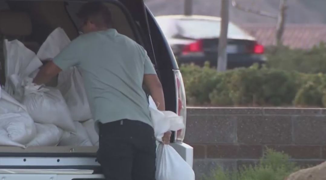
The storm will also bring gusty winds and high surf to the area. Homeowners who reside in flood-prone areas on hillsides in Santa Clarita's Canyon County were preparing by putting up sandbags around their properties. Recent burn areas, such as those in the Bobcat and Woolsey fires, are also at risk of flooding and mudslides.
California Highway Patrol issued a high wind advisory for the 14 Freeway just north of Ward Road in Acton and in the surrounding Antelope Valley.
Forecasters said Santa Barbara County was the biggest concern as far as burn areas go, where mud and debris flow was possible around the Alisal burn area. As a result, a Flash Flood Watch has been issued for that area from 6 a.m. to noon on Monday, and evacuations have been ordered for parts of that area.
By Monday afternoon, the rain will make its way to the Inland Empire and areas like Barstow, all the way down to Orange County. For those in O.C. that require sandbags, several fire stations have those available to residents.
"The front will continue to move southward and into San Diego County as we head later into the day," reported Alex Biston, a weathercaster for CBS Los Angeles. "We will dry out as we head into the evening hours and we will be dry as we head into the rest of the week."
The storm is expected to bring an inch of rain to areas like Oxnard and Camarillo, and a half-inch to Van Nuys, downtown LA, and Ontario. Over a quarter inch is expected in Santa Ana. Rainfall estimates are expected to be between 1 to 3 increases across the San Luis Obispo County.
Northern California was pummeled by the storm Sunday, known there as the "bomb cyclone." The storm drove a river of moisture towards the area with massive rainfall and strong winds.
According to CBS San Francisco, Sunday's rainfall totals for the Bay Area could be the seventh highest of all time.
While the rain won't end the drought, it is expected to end the risk of major wildfires for the season, experts say.
The storm will also bring heavy snowfall to the Sierra Nevada Mountains.