Drenching Rain Forces Alisal Fire Burn Area Residents In Santa Barbara County To Evacuate
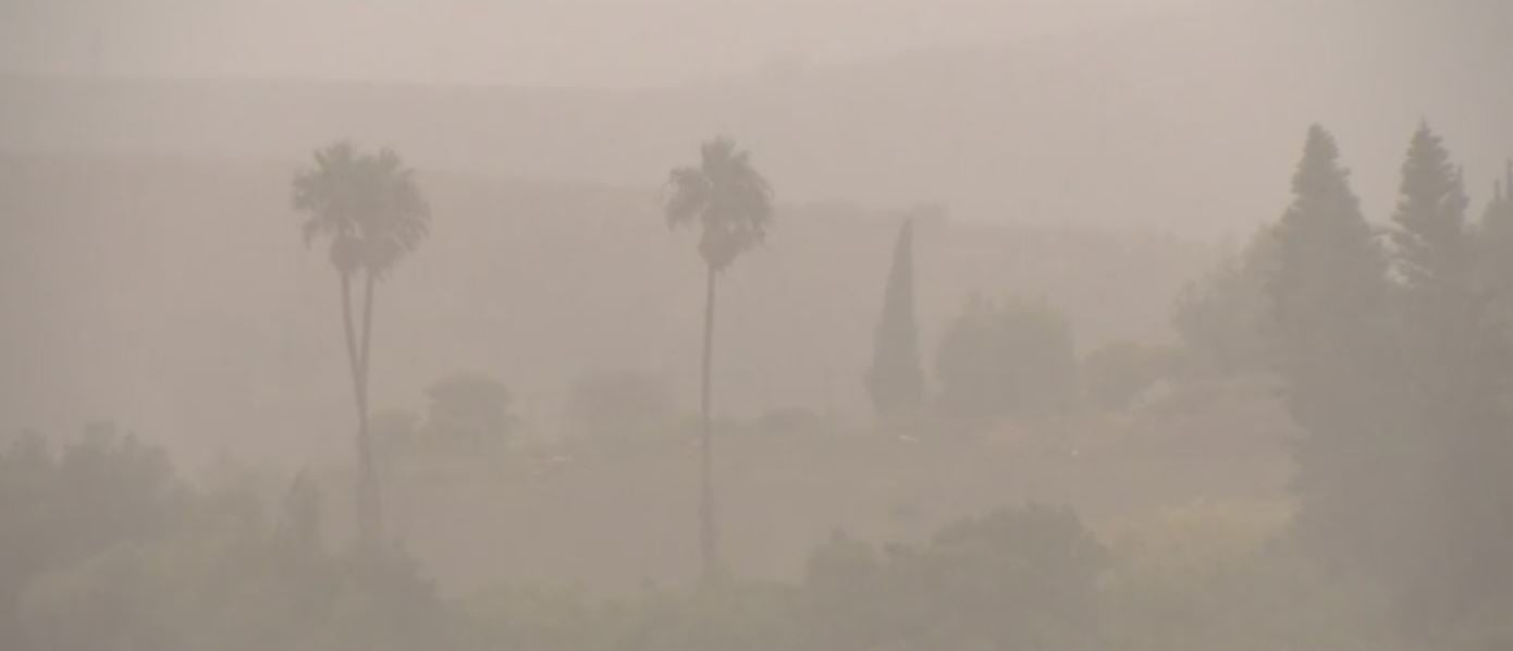
SANTA BARBARA (CBSLA) — Santa Barbara County residents in the Alisal Fire burn scar area were under evacuation orders as a powerful winter storm dumped heavy rain early Monday morning, bringing the risk of flooding and mudslides to the area.
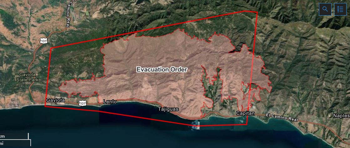
The Santa Barbara County Office of Emergency Management (OEM) issued an evacuation order Sunday for about 300 residents in the Alisal Fire burn area. The order, which took effect at noon Sunday, includes the following areas in and around the Alisal Fire burn scar:
• West of Las Flores Canyon.
• East of Mariposa Reina.
• South of West Camino Cielo; and down to the ocean.
A flash flood watch was in effect from 6 a.m. to noon Monday in the burn area. Santa Barbara County OEM asked canyon residents to leave before the rain arrives for fear of mudslides.
At around 8:30 a.m. Monday, a shelter in place alert order was issued for residents in the Alisal Fire burn area. They were told to stay indoors or go to higher ground.
The National Weather Service reported that the San Marcos Pass in the Santa Ynez Mountains recorded 1.05 inches of rain between 8 a.m. and 9 a.m.
"The debris fields up there, because of the burn scar, is already loose and is already preloaded to flood, and with intense rainfall, all of that's gonna break loose and come flying down the canyon," Tyson Butzke, a chief ranger with the California Department of Parks and Recreation told CBSLA Monday. "So that's why they're issuing the evacuation order, that's why they're telling folks now to shelter in place if they haven't gotten out yet because it's gonna be too dangerous to get through any of the roadways if they wind up mudding over."
Refugio Road was shut down just north of Santa Barbara. Kelly Hubbard, the county's OEM director, told CBSLA Sunday that the roads that run along Refugio Road are singular. There's only one way in, and only one way out.
"The canyons we are looking at, if they start flooding and they're not passable, these residents will be on their own for multiple days until those roads either clear of the flooding or if there's debris on the road such as mud or other debris form," Hubbard said. "We may not be able to get up those canyons to help them for a long time."
An evacuation center was set up at the SBCC Wake Center at the 300 block of N. Turnpike Road in Santa Barbara 93111.
"The earlier ahead of the storm you leave the safer you're going to be because there will be less rainfall in the area," Joshua Munsch of the American Red Cross said. "Less risk of debris flow while you're on road. We saw what happened on the highways up north and we don't wan to have that as a risk."
Another reason for the evacuation order is to prevent what happened in 2018, when Montecito was hit by a deadly mudslide caused by heavy rain in the burn scars of the Thomas fire.
Authorities want people to plan ahead as the rain may knock out power and electricity in the county.
The Alisal Fire broke out Oct. 11 amid powerful winds near Alisal Lake in the Santa Ynez Mountains west of Santa Barbara. It burned 16,970 acres, shut down the 101 Highway and forced dozens of people to evacuate. The fire destroyed 12 homes and damaged one other. The cause is under investigation. It was 97% contained as of Oct. 19.