Discover the Rails-To-Trails Hikes in SoCal
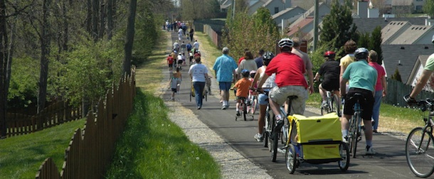
The whistle's blowing, time to hop on board a local Rail-to-Trails path. It's your ticket to healthy living.
The Rails-to-Trails movement began 40 years ago in the Midwest. The idea to turn abandoned deteriorating railroad tracks into thriving multi-purpose paths through urban and suburban neighborhoods was slow in building excitement and popularity, but today, the idea is moving ahead at full steam. To date the nationwide network of trails from old rail lines has created more than 15,000 miles of rail-trails for more than 100 million users per year.
The following is a list of Rail-to-Trails paths in Los Angeles, Orange County, and the Inland Empire.
The Duarte Trail was named after Andres Duarte, a Mexican soldier who was granted the land in the 1840's while it was still in Mexican ownership.
Today this former rail line is a multipurpose path with a mix of paved and parallel dirt ground cover connecting a park, school and hospital. It is perfect for walkers, bikers, inline skaters and even horseback riders.
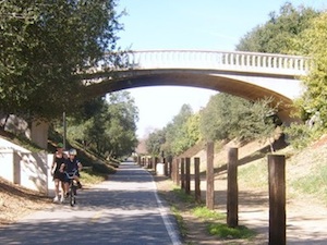
This is an easy trail, flat and short at 2.2 miles with lots of shade in middle of a quaint community. The eastern end of the route winds up in little Royal Oaks Park. Those who like to walk or run further can go past the Royal Oaks Park, enter the Upper San Gabriel and Santa Fe Dam recreation area, and connect to the Upper San Gabriel River Trail.
One of the crown jewels of the trail is a large bridge that provides access over the trail to a connecting neighborhood. In the spring, a field of wildflowers spreads along this section of the trail. Take your time to enjoy the flowers and rest on a bench or grab a drink at one of the water fountains.
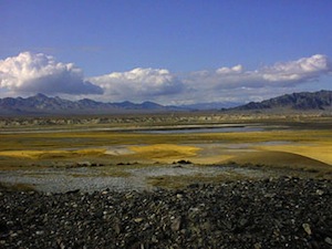
A trail for history buffs. The Armargosa River Trail follows a river of the same name, nestled between China Ranch and the quaint community of Tecopah. Along this route, explorers will find themselves following an abandoned corridor of the historic Tonopah and Tidewater Railroad, built around the turn of the 20th century.
Hikers will find this six-mile route, which also follows part of the Old Spanish Trail, moderately easy. There is a variety of wildlife, interesting geological features and even a waterfall for nature lovers to enjoy.
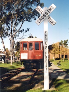
You can't beat a short trail that leads to the beach! The Rails-to-Trails Conservancy benefits trails of all sizes. The Electric Ave. Median Park is only a half-mile long but it runs straight through a linear park to a beach access point in Seal Beach. This short trail is great for those seeking a scenic route to walk their favorite pooch.
Cyclists can pick up the 39-mile San Gabriel River Trail from Electric Ave.
Along the trail, visitors can view a historical Pacific Electric "Red Car." This red car ran on the Pacific Electric Southern District, which was completed in 1902. In 1903, the town of Bay City was formed and the "Red Car" service began in 1904, transporting tourists and early residents. Bay City was incorporated in 1915 and renamed Seal Beach.
Mount Lowe
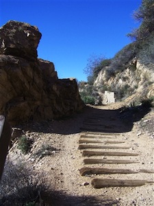
In 1893, the Mount Lowe Railway was built for tourists to ride along a scenic route between Mount Lowe and Echo Mountain. The train made its last run in 1938. This was the only scenic railway with an electric overhead trolley in the country. An incline up Rubio Canyon to the Echo Mountain House had a circular bridge loved by tourists.
Hikers today can access the ruins at Echo Mountain and the Alpine Tavern at Mount Lowe, which were destroyed by floods and fire. Historical markers that tell the story of the rail line can also be found. Visitors today may have to enjoy the view by foot instead of a train but it will be well worth the 5.8-mile effort when they see the amazing views of the Angeles National Forest.
There is not an exact address or easy access to this trail:
Directions: From Rails-To-Trails: To reach the access road and trailhead from Interstate 210 in Pasadena take the Lake Avenue exit. Head north on Lake Avenue for 3.7 miles to Loma Alta Drive, which is at the base of the steep massif. Turn left (west) on Loma Alta Drive and go for 1.1 miles to Chaney Trail; a flashing yellow light marks the road. Turn right (north) on Chaney Trail and follow this for 1.4 miles, passing a display about the Forest Adventure Pass, to a gate. If the gate is open, you can proceed for another 1.1 miles to a saddle where you will find another gate and the beginning of the paved access road. There is limited roadside parking.
The Tustin Branch Trail
(714) 744-7264
More Info
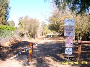
The Tustin Branch Trail is short at one-mile in length but it combines with other trails nearby. In 1905, the Tustin Branch Rail Line was the primary route used to deliver oranges from the Tustin Packing Co. to local markets. A flood washed out the Southern Pacific rail line in 1969. Today this trail has been revitalized and is near shopping centers and neighborhoods. For those who want a longer bike ride this disjointed rail-trail links with the Santiago Creek Bikeway from Wanda Road near Villa Park Road.
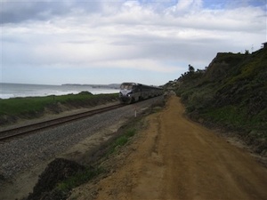
The quaint beach community of San Clemente is home to one of the most scenic shorelines and Rail with Trails beach line in Southern California. An active Amtrak that services the Los Angeles to San Diego community and the Metro link trains are part of the trail system. The Rail with Trail path enhances the San Clemente's small town charm and visitors can easily stop in from the beach and dine at one of the many restaurants and cafes downtown or visit the local beach shops.
Along this 2.3 mile trail walkers can enjoy the view of the ocean or the beautiful beach homes perched high on the cliffs. There is also a bridge for hikers to cross, averaging ten feet in height, built to avoid sensitive habitat.
Michelle Mears-Gerst is a freelance writer in Orange County. You can find her @sunnynsocal or on Facebook.