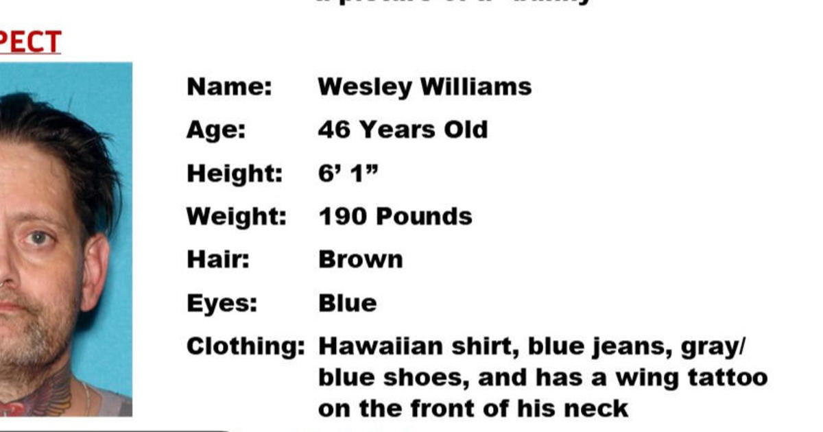
Josh Rubenstein's Weather Forecast (April 24)
STUDIO CITY (CBSLA.com) — With the wind advisories behind us, we turn our eyes to the west and the approaching cut-off low.
The marine layer is back for a repeat performance and beach communities will have a tough time clearing out today. The on-shore flow has strengthened and we will see temperatures drop for the next couple of days.
The cut-off low is expected drift over the border of California and Mexico late tonight into early tomorrow morning. This action will thicken up the cloud cover and give a chance at patchy drizzle and even a light shower. While the likelihood of any convection (t-storms) is slim to none, it's not a zero chance, so we will watch for it.
Once this system passes to the east we will see a slight warm up to near average levels.
Basin - upper 60s to low 70s
Beaches - mid 60s
Valleys - low 70s
Mountains - low 60s
Deserts - low 80s