Snow, Ice Shuts Down Grapevine As Storm Pummels Southland
LOS ANGELES (CBSLA) – Unstable weather brought snow, drenching rain and biting cold to the Southland Monday, creating hazardous driving conditions for drivers.
Snow levels were expected to drop as low as 1,500 feet.
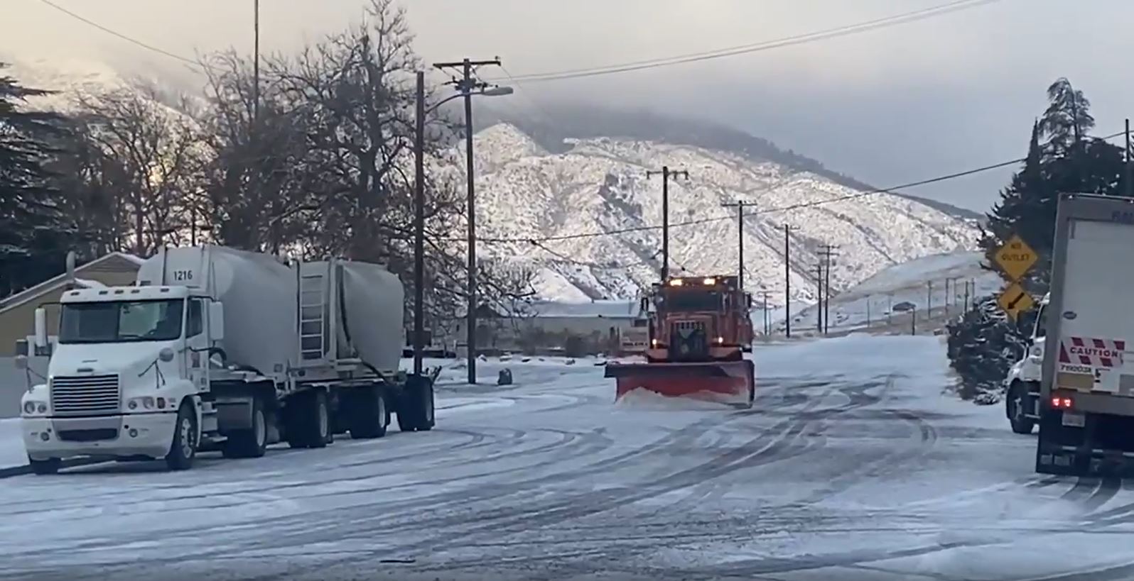
The 5 Freeway through the Grapevine was shut down just before 5 a.m. between Castaic and Fort Tejon due to snow and ice, California Highway Patrol reports. It remained closed as of 11 a.m., with no estimate on when it might reopen.
"I had to really slow it down, started seeing a lot of ice on the ground, started skidding a little bit," said trucker Cesar Ferreria, who was driving a big-rig carrying 75,000 pounds of groceries through the Grapevine just before it closed.
Ferreria said he nearly jackknifed while trying to park the truck. There were several vehicles stranded along the closed 12-mile stretch of the Grapevine.
"We had a couple of jackknifed big-rigs, some spin-outs, several spin-outs, and some vehicles that just can't get any traction," CHP spokesman Richard Anthes told CBSLA.
The northbound side was closed at Parker Road and the southbound side at Grapevine Road. Northbound drivers were advised to use the westbound 126 Freeway to the 101 Freeway as a detour.
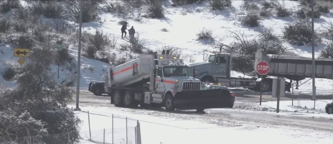
Snow plows were also busy clearing the icy 15 Freeway through the Cajon Pass.
Highway 33 was closed in the Los Padres National Forest north of Ojai, as was Highway 58 through the Tehachapi Pass in Kern County.
A winter storm warning is in effect for mountain areas in Los Angeles, Ventura and San Bernardino Counties -- excluding the Santa Monica Mountains -- through 10 p.m. Monday.
Elevations above 4,500 feet could see up to 8 inches of snow, while those above 3,000 feet could see up to 4 inches. The cities of Wrightwood, Crestline and Big Bear are all expected to see significant snowfall.
RELATED: 'Best Snow In Years:' Wrightwood Gets Lots Of Fresh Powder During Winter Storm
This all comes after the coastal enclave of Malibu over the weekend received some very rare snow flurries.
The valleys and coasts could see up to a half-inch of rain Monday, the National Weather Service reports. There's a chance hail and thunderstorms, with winds up to 65 miles per hour. The system moving into the Southland from the north was described by the NWS as "cold, showery and blustery."
There is some concern in the San Gabriel Mountains that the heavy rain could trigger debris flows in burn scar areas such as Monrovia.
In Orange County, widespread showers and thunderstorms were expected Monday as well.
Along the coast, health officials issued a beach water use advisory through 7:30 a.m. Wednesday. The county's chief health officer, Dr. Muntu Davis, cautioned residents that bacteria, chemicals, debris, trash, and other public health hazards from city streets and mountain areas are likely to contaminate ocean waters at and around discharging storm drains, creeks, and rivers after the recent rainfall. Individuals who enter the water in these areas could become ill.
This is the second of three storm fronts moving the region. Another, wetter storm was expected to reach the area beginning late Tuesday and last until next weekend.
(© Copyright 2020 CBS Broadcasting Inc. All Rights Reserved. City News Service contributed to this report.)