Containment More Than Doubles On Bobcat Fire
BOBCAT FIRE EVACUATION UPDATES
IRWINDALE (CBSLA) -- Weary firefighters working throughout the night made excellent progress, more than doubling containment lines early Wednesday morning on the stubborn Bobcat Fire burning in the Angeles National Forest and the Antelope Valley foothills.
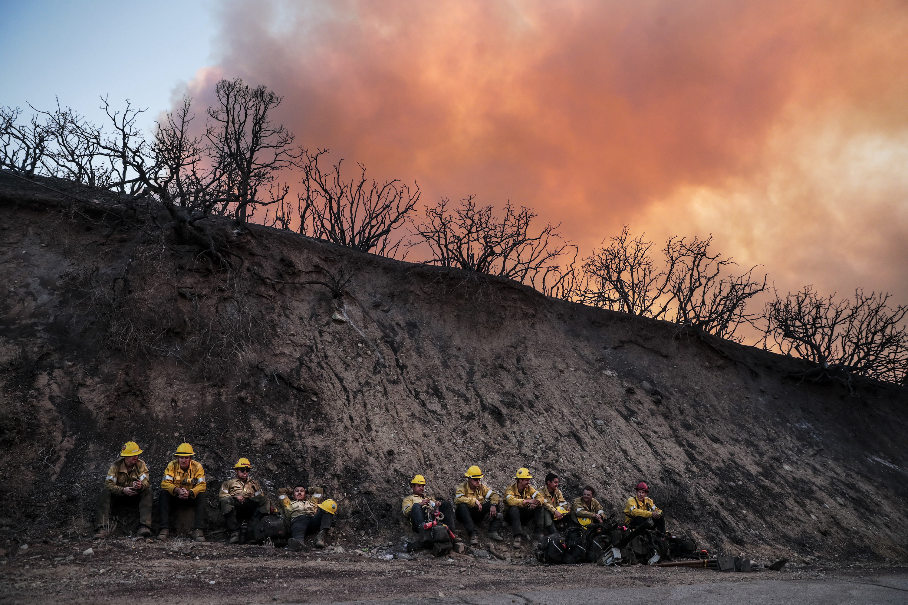
The fire, one of the largest in Los Angeles County history, has burned 113,733 acres as of Wednesday night and is 39% contained, up from 17% the day before. At least 29 homes have been destroyed or damaged. Most of the destruction appears to have occurred in the area around Juniper Hills. The Nature Center in the Devil's Punchbowl Natural Area was also destroyed.
About 90% of the Devil's Punchbowl has burned, L.A. County Supervisor Kathryn Barger reported Tuesday. The area covers over 1,300 acres.
The fire is burning on multiple fronts, creating challenges from crews. Evacuation orders remain in effect for several areas, including Upper Big Tujunga Canyon, Juniper Hills, Devils Punch Bowl, Paradise Springs and along the Angeles Crest Highway (State Route 2).
The fire is spreading in a "mosaic" fashion, officials say.
"It doesn't do it in a moonscape-like fashion, it does it in a mosaic, so there's little fires that can pop up everywhere, and that can be a challenge, because we only have so many resources," L.A. County Fire Inspector Sky Cornell told CBSLA Tuesday.
For the past several days, the fire has also threatened the historic Mount Wilson Observatory and several radio and television broadcast towers nearby, but crews stationed around the Observatory so far successfully protected it from the dangerous flames, some of which got within 500 feet. Overnight Tuesday, firefighters conducted a strategic backfire operation north of Mount Wilson up to Highway 2, the U.S. Forest Service reports.
The Bobcat Fire broke out a little after noon on Sept. 6 amid triple-digit temperatures near the Cogswell Dam and the West Fork Day Use area. The fire is churning through thick vegetation and dry brush in steep terrain, some of which has not burned in more 60 years.
The cause is under investigation. More than 1,500 firefighters are battling the blaze with the help of water-dropping helicopters and retardant-dropping planes.
Mandatory Evacuations:
- South and West of Upper Big Tujunga.
- East of Angeles Forest Hwy.
- North of Angeles Crest Hwy.
- Residences along Angeles Crest Highway, between Angeles Forest Highway and Highway 39.
- The unincorporated areas of Juniper Hills, Devils Punch Bowl, and Paradise Springs.
- The unincorporated areas of Crystal Lake, East Fork of the San Gabriel River, and Camp Williams.
- South of Hwy 138, North of Big Rock Creek, East of 87th St East, and West of Largo Vista Rd.
- South of 138th St. East, North of Big Pine Hwy and Hwy 2, East of Largo Vista Rd., and West of 263rd St. East.
- South of Hwy 138, North of East Ave W-14, East of 155th St East, and West of 165th St. East.
Evacuation Warnings:
- City of Pasadena
- Unincorporated communities of Altadena and Wrightwood.
- South of Pearblossom Hwy, East and North of Angeles Forest Hwy, North and West of Mt. Emma Rd., East and South of Hwy 122, and West of Cheseboro Rd.
- South of Hwy 2, North of Blue Ridge Truck Trail, East of Hwy 39, and West of the Los Angeles Co. border.
- South of Ave U-8, North of East Ave W-14, East of 121st East, and West of 155th St East. (Longview)
- South of Pearblossom Hwy (Hwy 138), South and East of Pearblossom Hwy (Hwy 122), North and West of Mt. Emma Rd., North and East of Angeles Forest Hwy, and West of Cheseboro Rd. (Emma)
- South of Mt. Emma Rd., North of Upper Big Tujunga Canyon Rd., East of Angeles Forest Highway, and West of Pacifico Mountain
- Littlerock: East of Cheseboro Road, South of Pearblossom Hwy, North of Weber Ranch Rd, West of 87th St E.