At Least 29 Structures Damaged Or Destroyed As Bobcat Fire Continues To Grow
IRWINDALE (CBSLA) – The Bobcat Fire continued to threaten hundreds of homes in the Antelope Valley Tuesday as it also ripped through dense brush in the Angeles National Forest to the south, with exhausted crews battling the blaze on multiple fronts.
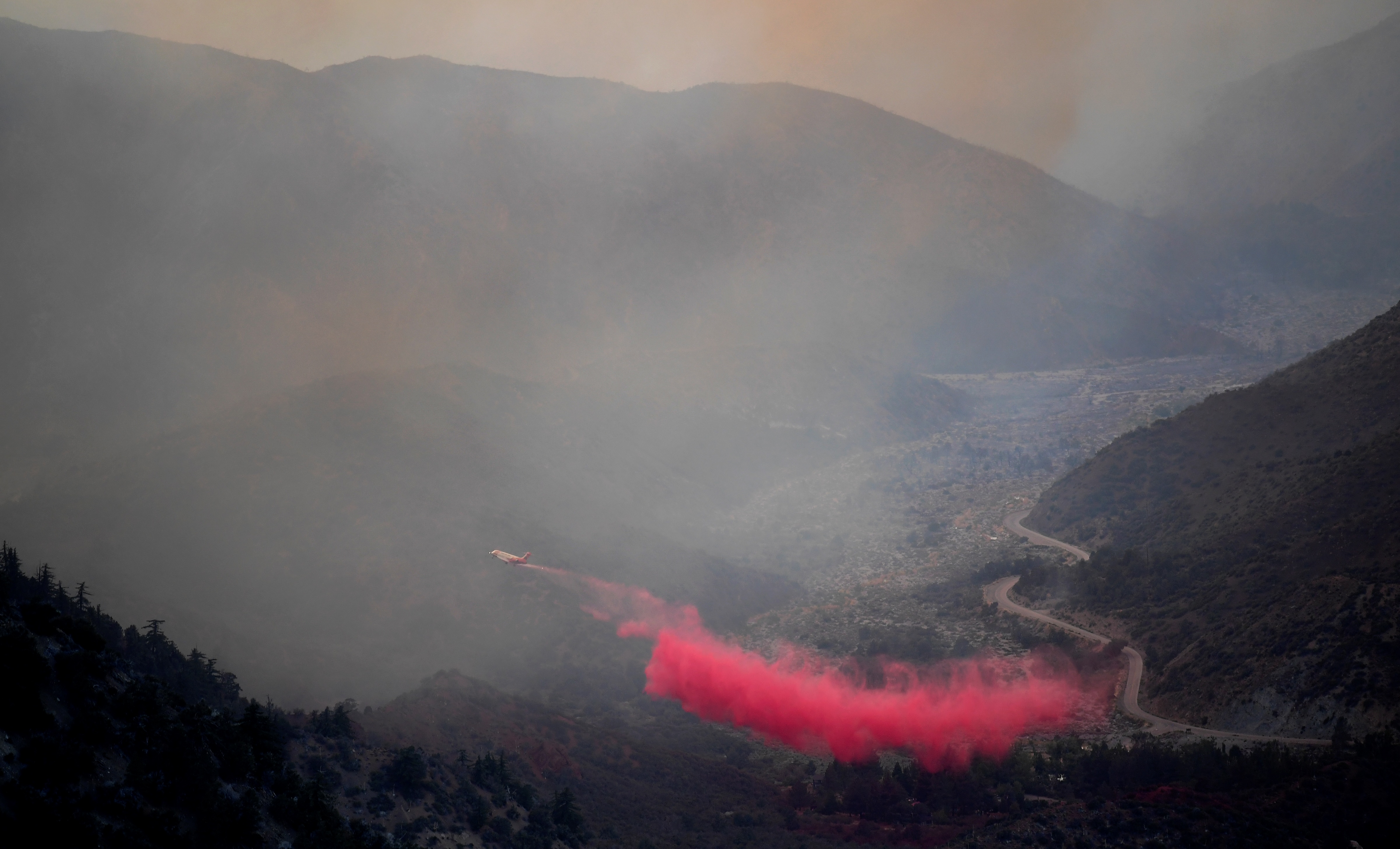
The fire has burned through 112,053 acres as of Tuesday evening, with containment up slightly to 17%, according to the U.S. Forest Service.
Containment on the fire had fluctuated Monday, dropping from 15% to 13% because the blaze was growing faster than crews can cut lines around it.
On the northern edge, the fire has damaged or destroyed at least 29 structures in the Antelope Valley foothills, the Los Angeles County Fire Department reported. It's unclear how many of those were homes. The Nature Center in the Devil's Punchbowl Natural Area was also destroyed.
The fire is spreading in a "mosaic" fashion, officials say.
"It doesn't do it in a moonscape-like fashion, it does it in a mosaic, so there's little fires that can pop up everywhere, and that can be a challenge, because we only have so many resources," Sky Cornell with the L.A. County Fire Department said Tuesday.
The blaze forced new evacuations Monday afternoon for the area southwest of the fire, around Upper Big Tujunga Canyon Road north of the Angeles Crest Highway, and east of the Angeles Forest Highway. That includes the communities of Hidden Springs and Colby Ranch.
Meanwhile, to the southeast, the fire continued to threaten the historic Mount Wilson Observatory and the $1 billion worth of radio and television broadcast towers near it. Flames burned in the hillsides north of the Observatory early Tuesday morning. The firefighters who have been stationed around the Observatory for several days have so far been successful at protecting it by setting backfires and with the help of an aerial attack.
"Mount Wilson was a high priority for us all day, it's actually been a priority for the last few days," Cornell said. "We've been able to take advantage of all of our air resources, both fixed wing and our helicopters, but also our ground crews."
More than 1,500 firefighters are assigned to the blaze.
The Bobcat Fire broke out a little after noon on Sept. 6 amid triple-digit temperatures near the Cogswell Dam and the West Fork Day Use area. The fire is churning through thick vegetation and dry brush in steep terrain, some of which has not burned in more 60 years.
The cause is under investigation.
Mandatory Evacuations:
- South and West of Upper Big Tujunga.
- East of Angeles Forest Hwy.
- North of Angeles Crest Hwy.
- Residences along Angeles Crest Highway, between Angeles Forest Highway and Highway 39.
- The unincorporated areas of Juniper Hills, Devils Punch Bowl, and Paradise Springs.
- The unincorporated areas of Crystal Lake, East Fork of the San Gabriel River, and Camp Williams.
- South of Hwy 138, North of Big Rock Creek, East of 87th St East, and West of Largo Vista Rd.
- South of 138th St. East, North of Big Pine Hwy and Hwy 2, East of Largo Vista Rd., and West of 263rd St. East.
- South of Hwy 138, North of East Ave W-14, East of 155th St East, and West of 165th St. East.
Evacuation Warnings:
- City of Pasadena
- Unincorporated communities of Altadena and Wrightwood.
- South of Pearblossom Hwy, East and North of Angeles Forest Hwy, North and West of Mt. Emma Rd., East and South of Hwy 122, and West of Cheseboro Rd.
- South of Hwy 2, North of Blue Ridge Truck Trail, East of Hwy 39, and West of the Los Angeles Co. border.
- South of Ave U-8, North of East Ave W-14, East of 121st East, and West of 155th St East. (Longview)
- South of Pearblossom Hwy (Hwy 138), South and East of Pearblossom Hwy (Hwy 122), North and West of Mt. Emma Rd., North and East of Angeles Forest Hwy, and West of Cheseboro Rd. (Emma)
- South of Mt. Emma Rd., North of Upper Big Tujunga Canyon Rd., East of Angeles Forest Highway, and West of Pacifico Mountain
- Littlerock: East of Cheseboro Road, South of Pearblossom Hwy, North of Weber Ranch Rd, West of 87th St E.