Massive Bobcat Fire Grows To More Than 93,000 Acres, Continues To Threaten Homes In Juniper Hills
BOBCAT FIRE EVACUATION UPDATES
ARCADIA (CBSLA) -- New evacuations have been ordered for residents in the foothills north of the Bobcat Fire on Saturday.
The Bobcat Fire has grown to 93,842 acres and remains at 15% contained as of Saturday evening
"Today, crews will focus on securing the fire's perimeter in the north in an effort to stop any additional spread, especially to the communities in the northeast and northwest,'' the U.S. Forest Service said.
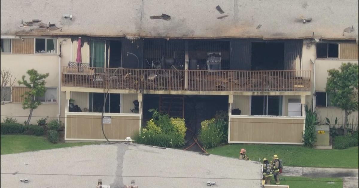
The blaze threatened several structures on Friday, making a run to the north that pushed deeper into the Juniper Hills area by late afternoon. The number of homes affected has not been confirmed.
Wind gusts peaked at 44 mph in the Angeles National Forest near the border of Los Angeles County and San Bernardino County, according to the National Weather Service, causing issues for crews.
"Biggest challenge is weather, right? A lot of it revolves around weather visibility, so for about 3 to 5 days we couldn't get any aviation assets up here to help," said Oscar Vargas, Division Chief of the U.S. Forest Service. "This is old growth brush and big trees with not so much fire in the last 100 years so the buildup was there, a lot of steep terrain that caused the fire to run up hill a lot faster, so we're seeing the extreme ends of fuel conditions, weather, and topography."
A smoke advisory for unhealthy air quality due to the fire has been extended through Sunday.
The Bobcat Fire broke out a little after noon on Sept. 6 amid triple-digit temperatures near the Cogswell Dam and the West Fork Day Use area. The fire is churning through thick vegetation and dry brush in steep terrain, some of which has not burned in more 60 years.
The cause is under investigation. More than 1,600 firefighters are battling the blaze.
Evacuation Orders:
- North of Angeles Crest North and between Clear Creek Station and Hwy 39.
- Including the area East of Devils Punch Bowl Rd, South of the Big Pines Hwy, North of the Big Rock Creek, and West of Jackson Lake.
- Aqueduct - South of Pearblossom Hwy (SR138), North of Big Pines, East of 165th and West of Largo Vista Rd
- Ward- North of Fort Tejon Rd, South of Avenue V, East of 87th E., West of 121 St E.
- Longview-South of Avenue 12, North of Aqueduct, West of 165 St E and East of 121 St E.
- Tejon - South of Fort Tejon Rd, North of Cooley Place, East of 89th St. E. and West of Longview Rd.
- Peach - North of Pallett Creek, South of W. 114th St., East of Longview Rd and West of 165th St.
- Cima Block - 96th east to 116th St. E/Fort Tejon Rd south to SR 2
- Juniper Block- 116th E to Devis Punchbowl Rd / Fort Tejor Rd to SR 2
- Punchbowl Block - Devils Punchbowl Rd to and including Fenner Camp
- Paradise Block - Fenner Camp to intersection of SR 2 and Big Pines
- Chilao, the CalTrans Yard, the 3 Points area and the Angeles Crest Christian Camp were all issued Evacuation Orders Crystal Lake area remains under Evacuation Order.
- South of 138th St East, North of Big Pines Hwy and Hwy 2, West of 263rd East, East of Largo Vista Rd.
Evacuation Warnings:
- Wrightwood
- Monrovia
- Bradbury
- Sierra Madre
- Arcadia
- Altadena
- Duarte
- Pasadena.
- Residents North of Foothill Blvd. and east of Santa Anita Ave.
A Red Cross Evacuation Center has been established at Palmdale High School, located at 2137 E Avenue R, Palmdale, 93550. The first evacuation point at Santa Anita Park is now closed and anyone still needing assistance can call the Disaster Distress Hotline at 800-675-5799. The Red Cross is committed to helping all those affected by the Bobcat Fire and evacuation orders.
Road closures:
- Highway 2 closed from east of Angeles Forest Highway to Big Pines.
- Highway 39 closed from San Gabriel River Bridge to Highway 2.
- Upper Big Tujunga Canyon Road closed Angeles Forest Highway to Highway 2.
For updated information on evacuations, look out for alerts from local officials, including the L.A. County Sheriff's Department and the national incident management website.
(© Copyright 2020 CBS Broadcasting Inc. All Rights Reserved. City News Service contributed to this report.)