Southern California Preps As Weakened Cyclone Brings Rain
LOS ANGELES (CBSLA.com) — After a sweltering week of triple-digit-degree temperatures, Southern California is facing rain and high winds, especially in the Antelope Valley.
A low-pressure system will combine with lingering moisture from former tropical Cyclone Linda to periods of rain to the region between Monday and early Wednesday.
The trajectory of the expected storm system and the volume of rain it will generate is not certain, but National Weather Service forecasters said coastal slopes and foothills will experience the highest rainfall amounts.
"On again, off again rain, probably tomorrow morning will be the best chance of rain for the LA area and that will last us through tomorrow afternoon," National Weather Service Senior Meteorologist Andrew Rourke said. "Looking at maybe a half inch although, honestly, we've been fooled by these systems before and sometimes you get a little bit more rain than you think."
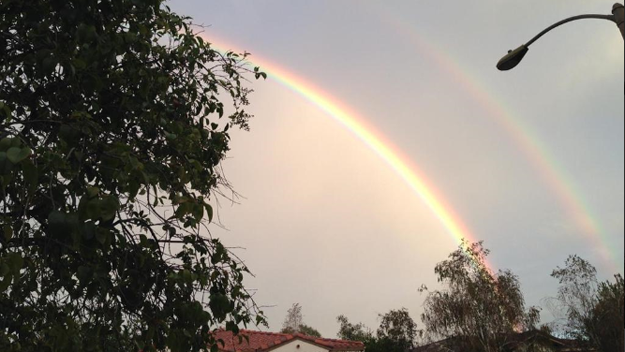
Scattered showers were reported Monday in parts of the San Fernando Valley, along with a double rainbow.
"Since many areas have seen little or no rainfall in the past couple of months, buildup of oil on the roadways could lead to extra slippery driving conditions" once rain starts falling, the statement warned.
Moreover, "minor urban roadway flooding will be possible in Los Angeles County, which could be worsened by clogged storm drains and culverts."
And any time there's a chance of rain, residents in Glendora watch the forecast closely. A wildfire left the ground unable to soak in much water, causing roads to flood. So, concrete highway barriers now line residential streets.
Since the weather system is the product of a warm mass of subtropical air, it will not produce any snow, forecasters said. But it will generate high winds on Tuesday, when gusts of more than 40 miles per hour are expected in the Antelope Valley and mountain areas, they said.
A wind advisory will be in effect from 11 a.m. to 9 p.m. Monday in the Antelope Valley, where winds of between 20 and 30 miles per hour are expected, along with 50-mph gusts.
The strongest winds are forecast to swirl in the western tier of the Antelope Valley, forecasters said, adding that drivers should beware of crosswinds.
Temperatures, meanwhile, will be several degrees lower than during last week's heat wave, when highs topped 100.
(©2015 CBS Local Media, a division of CBS Radio Inc. All Rights Reserved. This material may not be published, broadcast, rewritten, or redistributed. Wire services contributed to this report.)